Nepal’s Upper Mustang is an ethnically Tibetan area north of the Annapurna Circuit. Once an important player in cross-Himalayan trade Upper Mustang, or the Kingdom of Lo as it was once known, was annexed by Nepal two centuries ago. The gompas (monasteries) contain some of the finest Tibetan frescoes in the world.
Upper Mustang was once an important religious and salt trading post. Over 10,000 mainly inaccessible caves are scattered across Mustang and archaeological investigations commenced in 2007 (or link here). In 1992 trekking was first permitted in the area, though it is still kept exclusive with a hefty trekking permit fee of US$ 500 per person for 10 days.
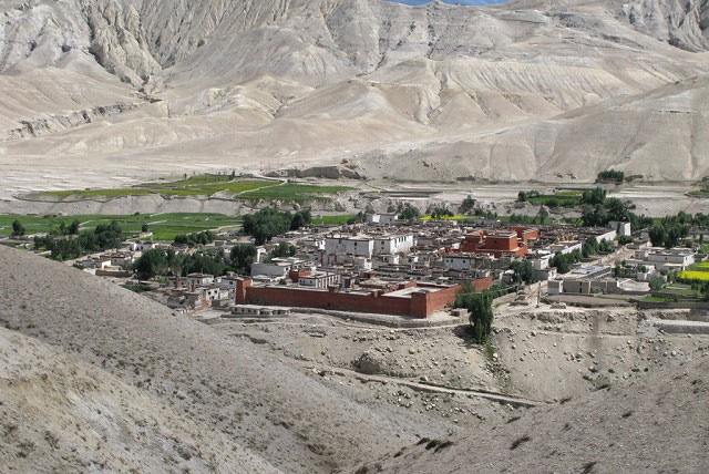
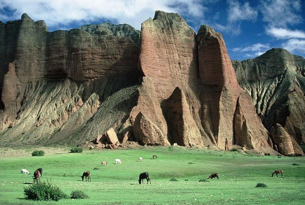
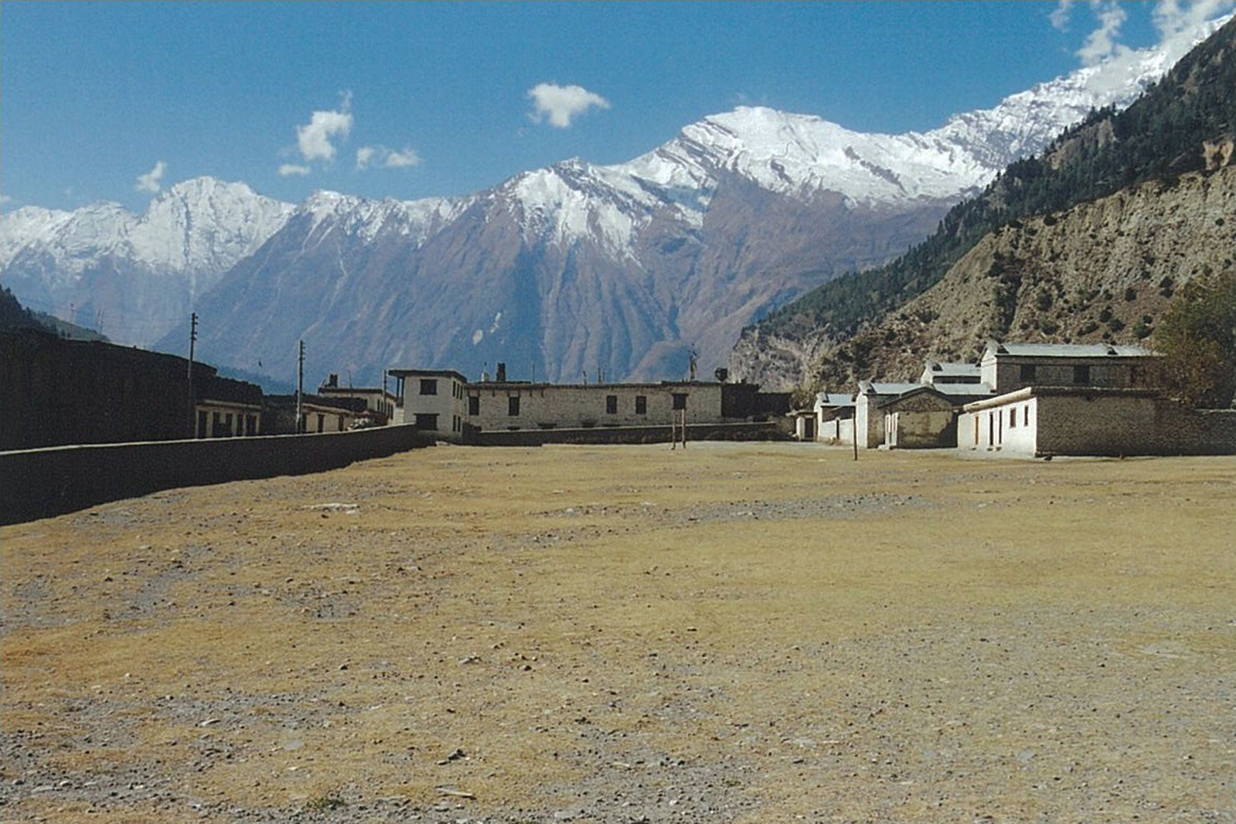
The fantastic walled medieval capital village of Lo Manthang is set amidst a lunar landscape of wind-eroded hills and cliffs. Life in Upper Mustang revolves around trekking, farming and trade. The total population of approximately 7,000 live in three main villages and 30 hamlets around the Kali Gandaki River, though many migrate to a lower altitude for the winter.
If you’re going to trek there do it now before permits drop in price and the place fills up with ogling Westerners, the villages are not big enough for that, and before the Chinese build a main road from Lhasa through Nepal to India, it’s planned even if it’s stalled for now.
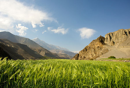
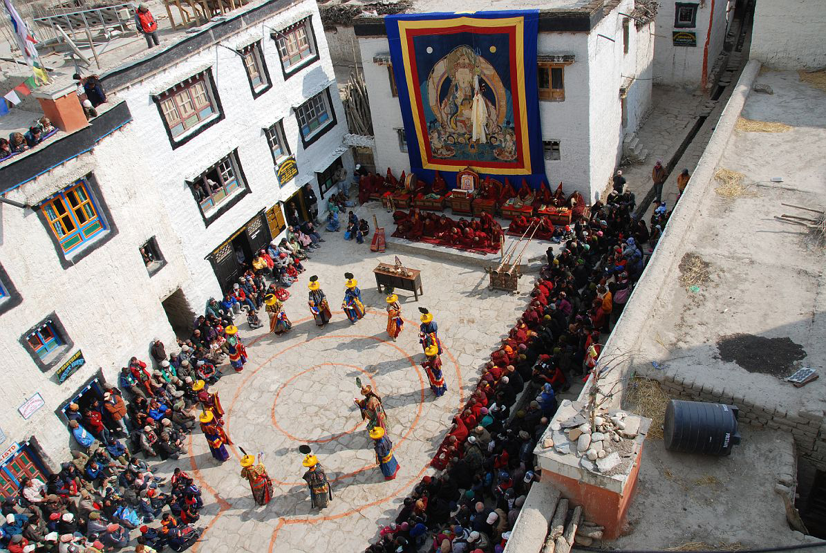
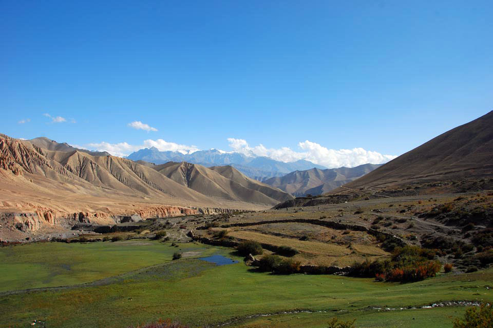
This is a challenging camping or tea-house trek that, as there’s little rain in the Annapurna Massif rain-shadow, can be done any time from May to late November. The famous Teechi festival is in May, though it can be windy and dusty at this time of year. From mid-August to mid-September the colours of the ripening crops mix well with the hues of the mountains, a veritable artists’ dream. Tea-houses on this trek can be fairly basic and it can get very cold and windy here in the winter.
For the more adventurous and physically fitter a return trek from Lo Manthang, via spectacular canyons, past caves with recently discovered 12th Century paintings and a fortified village, can be made via Dhi, Yara, Tange, Tetang, and Muktinah. Allow for 10 hour hikes.
| Day 1 | Kathmandu to Pokhara We drive from Kathmandu to the vibrant resort area of Lakeside, Pokhara, from where you can observe views to the north across the hills to the white peaks of the Annapurna and Dhaulagiri ranges, go boating on Fewa Lake or just wander around. |
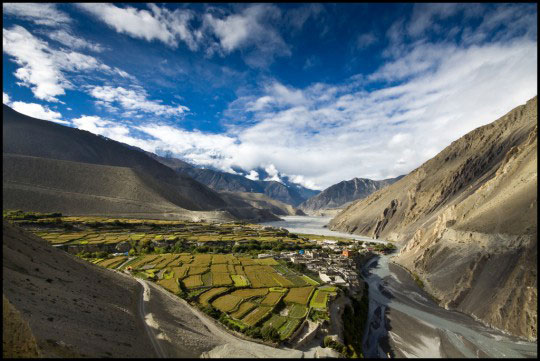
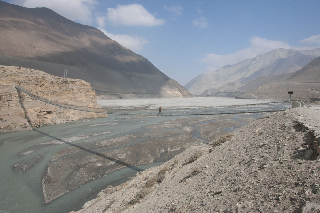
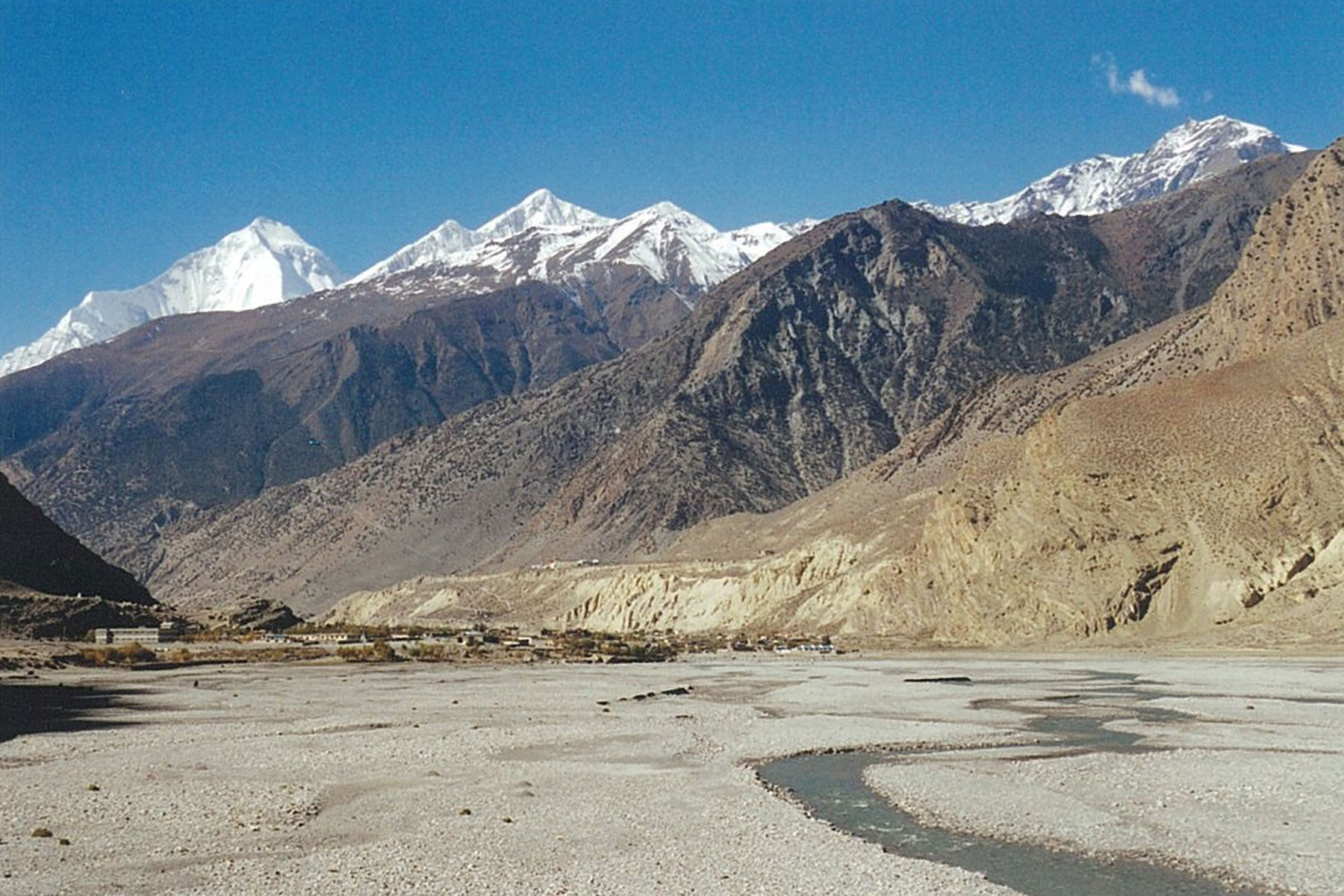
| Day 2 | Fly to Jomsom and trek to Kagbeni (2,780m) Your trekking guide will arrive at your hotel and, after breakfast, we take the spectacular early morning flight to Jomsom and begin our trek alongside the Kali Gandaki riverbed to the pretty village of Kagbeni. This bit of the hike is flat and quite barren, with craggy rocks and pebbles littering the trek. We get magnificent views of huge peaks such as Dhaulagiri, Tukuche and the Nilgiri Himal, whilst to the south can be seen the entire Annapurna Massif. Kagbeni with its narrow alleyways and tunnels, irrigation canals, fields of wheat and barley and large red gompa, gives us a preview of scenes that we will come across in Upper Mustang. At the north end of the village is the police check-post. Here we complete our paperwork before entering this long forbidden region of Nepal. (4 hours trekking). |
| Day 3 | Kagbeni to Chhuksang (2,920m) It is possible to trek right up the river valley, but we use a combination of a high trail and the riverbank pathways. The trek enters a stark wilderness of towering cliffs eroded into fantastical shapes by the wind, which howls every afternoon, before widening significantly to reveal an endless stretch of sand. We should also encounter mule trains bearing goods to and from Mustang and Tibet. On the west bank of the river are some caves and Gompa Kang, which, unlike most monasteries in Upper Mustang, is of the Nyingmapa rather than the Sakyapa sect. We stop for lunch at the Thakali village of Tangbe, where we come across the first black, white and red chortens that typify Upper Mustang. The village is a labyrinth of narrow alleys among whitewashed houses, apple orchards and fields of buckwheat and barley. The Gurung village of Chhuksang is only about 2 hours hike beyond Tangbe at the confluence of the Narshing Khola (river) and the Kali Gandaki. There are three separate parts to Chhuksang and some ruined castle walls on the surrounding cliffs. Across the river are some spectacular red cliffs above the mouths of inaccessible caves. (5 hour trek). |
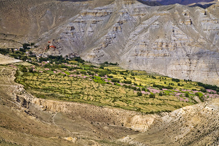
| Day 4 | Chhuksang to Samar (3,290m) There is a distinct change here, not only in topography, but also in the culture and lifestyle of the people. The settlements become more scattered, smaller and more basic and, due to a lack of rain and fertile soil, cultivation is limited to watered and sheltered plots of land, which decorate the brown landscape with patches of green. Many of the inaccessible caves high on the opposite side of the river were once used as living quarters or burial places. Continuing north, the Kali Gandaki becomes unfollowable, a steel bridge spans the river and the trek now leaves the valley and we hike steeply up a rocky gully to the village of Chele, where ferocious Tibetan mastiffs are chained to many of the houses. From Chele we hike up a steep spur and then continue trekking along the side of a spectacular steep canyon to Chele La (pass) at 3,630m. Beyond the pass we hike down on a pleasant trek to a grove of poplar trees and the village of Samar. This is a major stopping place for horse and mule caravans. (5 hour trek). |
| Day 5 | Samar to Geling (3,440m) We trek up above Samar to a ridge and then hike down into a large gorge before entering a valley filled with juniper trees. We then cross a stream and, after hiking up to Bhena La (3,860m), trek along a ridge to Shyangmochen, a tiny settlement with a few tea-shops. Nearby is Rangbyung a cave containing stalagmites in the shape of a chorten and one of the holiest places in Mustang. The trek climbs gently to Shyangmochen La (3,850m) and we enter a huge valley before hiking down to the picturesque village of Geling with its extensive fields of barley. Like all the settlements in Mustang the white and ochre-painted houses in Geling are constructed of mud and stones and the roofs of twigs, straw and a mixture of mud and pebbles. (5 hour trek). |
| Day 6 | Geling to Ghami (3,460m) From Geling the trek climbs moderately through fields, up the centre of the valley, we hike above the settlement of Tama Gun and an imposing chorten. We then begin a taxing trek up to cross the Nyi La (4,020m). We hike gradually down to Ghami, a large whitewashed village sheltered by overhanging cliffs. (5 hour trek). |
| Day 7 | Ghami to Charang (3,490m) After leaving Ghami we cross the Tangmar Chu (river) and trek up past the longest and most spectacular mani wall in Nepal before hiking to Choya La (3,870m). Once we’ve trekked through the pass we make a long gentle hike down to the former Lo capital of Charang, a large spread-out village atop the Charang Chu canyon. At the eastern end of the village are a huge dzong (fortress) and a red gompa which houses an excellent collection of statues and thangkas. Today’s trek is through perhaps the driest part of Mustang, and much of our energy will be spent negotiating the loose, dry soil. However, the magnificent views of the countryside, from the gentle contours of the north to the rugged mountains in the east and west, more than compensate for the hard hiking. (3 hour trek). |
| Day 8 | Charang to Lo Manthang (3,730m) We trek gently up above the valley to a large isolated chorten that marks the boundary between Charang and Lo Manthang. The trek then broadens as we cross a multi-hued desert-like landscape and eventually we get our first view of the walled city of Lo Manthang. The city has only one entrance so we circumambulate the wall to the gate on the north-east corner. (3 hour trek). |
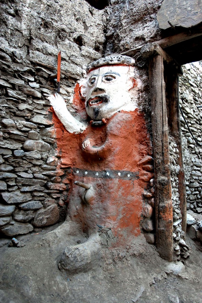
| Day 9 | Rest Day Today we explore the fascinating village of Lo Manthang. The village contains about 150 houses, as well as residences for its many lamas, and holds a population of about 1,100 – in 1962 it contained 12 dukes, 60 monks, 152 families and 8 witches, so there you go. There are 4 major temples within the city and 1 of these, the 15th century Champa Lhakang, contains a huge clay statue of the future Buddha and has elaborate mandalas painted on the walls. The similarly dated Thubchen Gompa has statues of the Buddha, Chenresig, Vaisravana and Guru Rinpoche. The other 2 gompas are newer. The Raja’s (King’s) Palace, occupied by the current Raja and his queen, is an imposing building in the village centre and, although his duties are largely ceremonial, the Raja is respected by the people with villagers seeking his advice on many issues. To the north are 2 hills, the more prominent from which views can be had to the south and the distant Annapurna Massif. The lower hill is used for the Tibetan practice of leaving the dead out to be eaten by birds. It is possible to hire ponies (about 500 Nepali rupees a day extra) to visit surrounding valleys; Tingkhar, the site of the Raja’s summer palace and Chosar, the site of 2 gompas and some bizarre cave-dwelling edifices. Chosar is on the old trading route to Lhasa. |
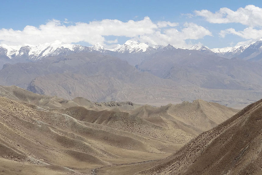
| Day 10 | Lo Manthang to Lo Gekar (3,820m) We begin our return trek from Lo Manthang by taking the upper highland route and hiking across the Chogo La, at 4,325m the highest point of the trek. This offers dramatic views of Lo Manthang and the Charang Valley with snow-clad peaks in the background. Just past the settlement of Lo Gekar we reach Ghare Gompa, the oldest monastery in Mustang. (3 hour trek). |
| Day 11 | Lo Gekar to Ghami (3,460m) We continue our trek on the highland route crossing alpine meadows before dropping down a steep eroded gully to Drakmar for lunch. After lunch, we hike through a pretty valley with shades of grey and yellow and blood-red cliffs above. We hike up a ridge and trek down from there back to Ghami. (6 hour trek). |
| Day 12 | Ghami to Chhuksang (2,920m) Now we must retrace our trek back over the Nyi La to Chhuksang. The Nilgiri Himal, Nilgiri South (6,839m), Nilgiri Central (6,940m) and Nilgiri North (7,061m) dominate the southern skyline. (6 hour trek). |
| Day 13 | Chhuksang to Jomsom (2,710m) It’s a long and sad final day, hiking back through Kagbeni to Jomsom, where we end our trek. It’s now time for us to take a nice hot shower. In the evening, we celebrate with the crew, whom we have come to know well over the last 2 weeks. (6 to 7 hour trek). |
| Day 14 | Fly to Pokhara We take the spectacular early morning flight along the Kali Gandaki Gorge back to Pokhara. |
| Day 15 | Pokhara to Kathmandu We return to Kathmandu, though alternatively you could take the opportunity to paraglide near Pokhara with or without an instructor. Tandem flights cost from $US 95 to US$ 130. We hope you’ve had a great trek, had some adventures, tightened your belt a few notches and look forward to trekking with you again on your return to Nepal. |
| Ballpark price; US$ 2,000 plus transport to and from Pokhara and accommodation in Kathmandu and Pokhara. This price is valid for both tea-house and camping treks, though less than 4 campers would cost more per person. |
| Price includes airport pick-ups and drop-offs. All inclusive trek costs; all camping equipment, breakfast, lunch, dinner, trekking and park permit fees, flights to and from Jomsom, guide and necessary porters and all their costs such as transportation, accommodation, food, equipment, insurance etc. |
| Price excludes accommodation and food in Kathmandu and Pokhara, transport between Kathmandu and Pokhara, alcoholic beverages, tips, your insurance and personal expenses. |



Leave a Reply
Want to join the discussion?Feel free to contribute!